RESULTS FOR GRID SQUARE 19
MAPS FOR GRID SQUARE 19
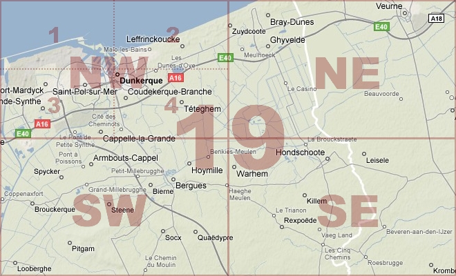
Map Location Diagram
- The Map Location Diagram (right) shows the relative position of places within the area of this grid square.
- Maps having this Map Reference Number will cover the whole area but be less detailed.
- Maps with NE, NW, SE or SW in the Map Reference Number will only cover one-quarter of the whole area but be more detailed.
- Click the following links for more information about How to Read a Map Reference Number or about Map Scale.
Maps for Grid Square 19
| Link to Image | Map Sheet Number | Scale | Area | Date |
|---|---|---|---|---|
|
309WW1MAP |
19 | 1:40,000 | Dunkerque | 1917/10 |
|
369WW1MAP |
19 | 1:40,000 | Dunkerque | 1917/10 |
|
217WW1MAP |
19 | 1:10,000 | Gaurelle | 1917/05 |
|
140WW1MAP |
19 | 1:100,000 | Mezieres | 1915/11 |
|
416WW1MAP |
19 | 1:100,000 | Mezieres | 1916 |
|
PC0739WW1MAP |
19 NE | 1:40,000 | Bray Dunes - Alveringhem | 1917/07 |
|
PC0195WW1MAP |
19 NE | 1:20,000 | Bray Dunes - Alveringhem | 1915/00 |
|
PC0851WW1MAP |
Part of 19 | 1:1,000,000 | Dunkerque - Basel |
AERIAL PHOTOGRAPHS FOR GRID SQUARE 19
There are no aerial photographs in our collection for this area
Contact: mapref@mcmaster.ca